Certain datasets provided by Trafikkontoret are fairly large and can introduce certain issues with QGIS.
The main issue is adding WFS layers as it requires one to download the dataset before QGIS can start working with it.
The Open Data service has an internal timeout for network requests which may interrupt it before it completes.
For example the "NVDB - Funktionell vägklass" dataset is likely to introduce this problem.
To prevent these problems from occuring one can active feature paging for the WFS connection in QGIS.
In order to do this follow these steps:
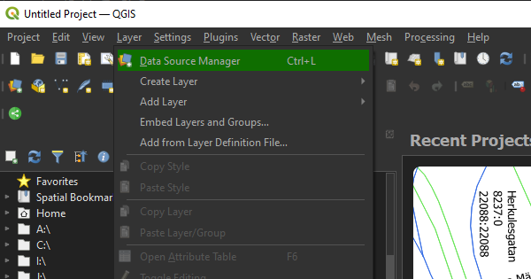
1) Enter the "Layer" menu and choose "Data Source Manager".
2) Enter the "WFS/OGC API - Features" tab and choose either "New" or "Edit" depending on if you are creating a new connection or modifying an existing.
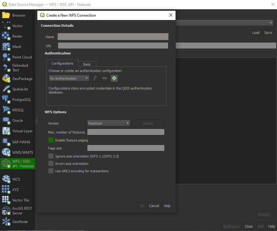
3) Make sure the checkbox for "Enable feature paging" is ticked and that no value is entered for "Max. number of features". QGIS will now optimize fetching of features from the WFS service.
Press "OK" to save your changes.
You should now be able to utilize larger datasets without experiencing timeouts when adding the layers.
Another issue with QGIS when using large datasets is its rendering process. Whenever the map is panned, QGIS calls a re-rendering of the map.
If the dataset is large and possibly use advanced thematises it can take some time for this rendering proccess to complete.
If one has issues with the rendering times one can do a few things to improve the experience.
First one can introduce multi-threaded rendering. Clients with multi-core processors should experience a slight boost from activating this option.
However, this only helps if multiple layers are present in which case QGIS will render each layer individually on separate threads.
To activate this option follow these steps:
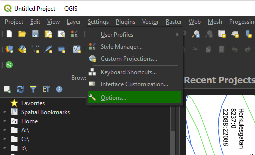
1) Enter the "Settings" menu and choose "Options".
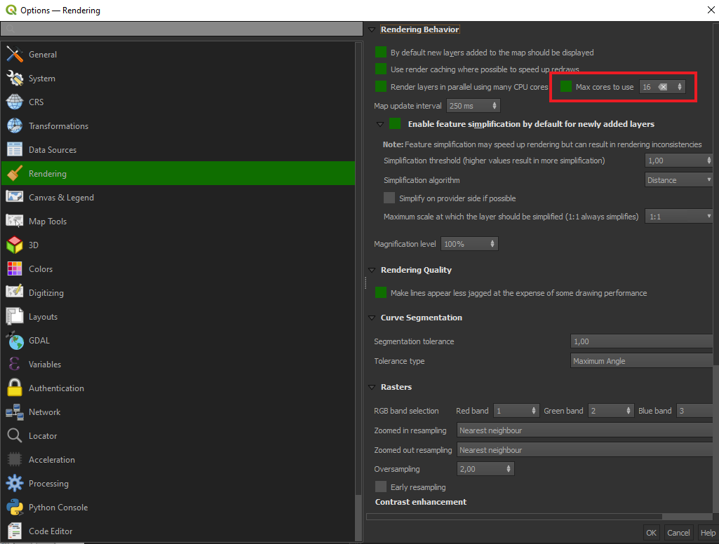
2) Enter the "Rendering" tab.
3) Then increase the value of "Max cores to use" which is in the "Rendering Behavior" section.
4) Press OK to save.
QGIS will now whenever possible use more system resources to render the layers faster.
If one wants to pan the map but does not require a re-render one can also quickly disable the rendering all together by unchecking the "Render" option in the lower right corner of QGIS.

This mean QGIS will not re-render the map at all even if the map is panned. However, this also makes QGIS not render new sections of the map until the option is rechecked.