Start by downloading the appropriate version of QGIS from https://www.qgis.org/en/site/forusers/download.html and follow the instructions to install the program.
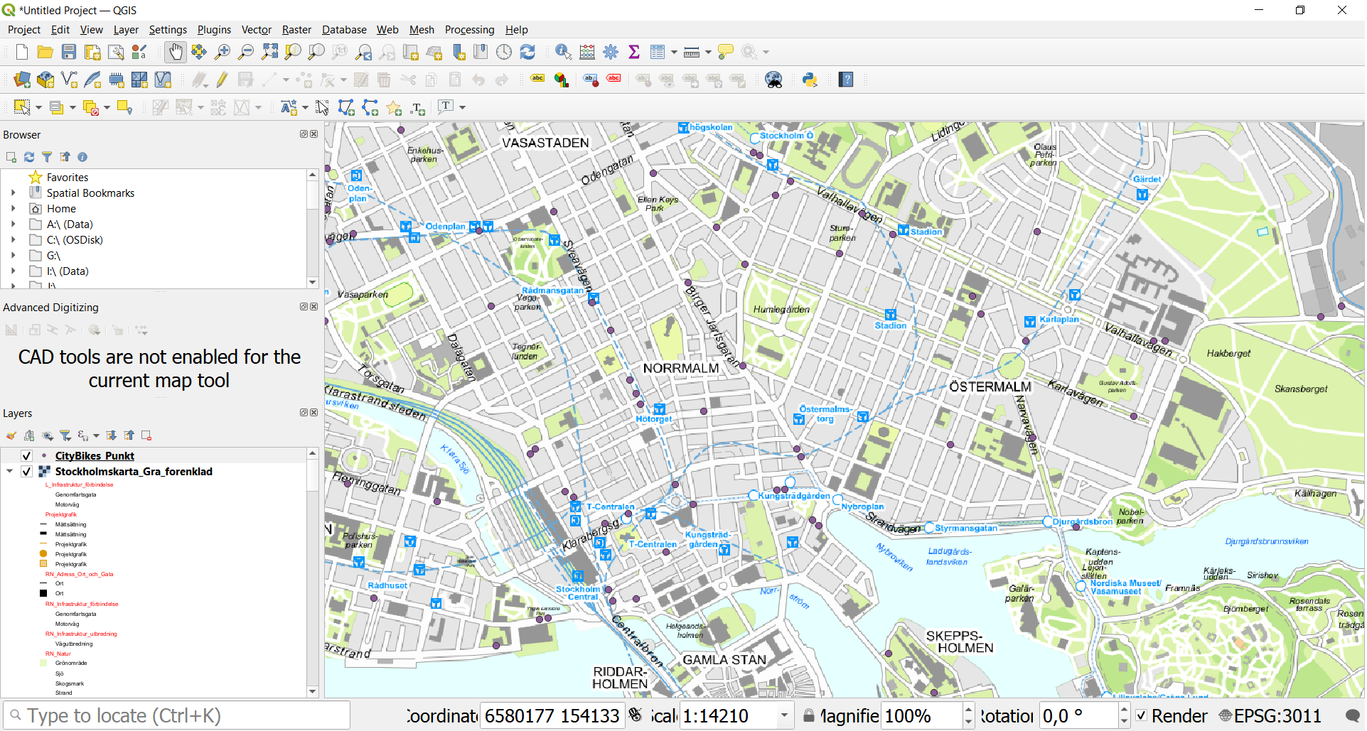
1) We can begin by importing the Stockholm City map.
Open the address http://dataportalen.stockholm.se/dataportalen/
From here search for "stockholmskartan" in the search field.
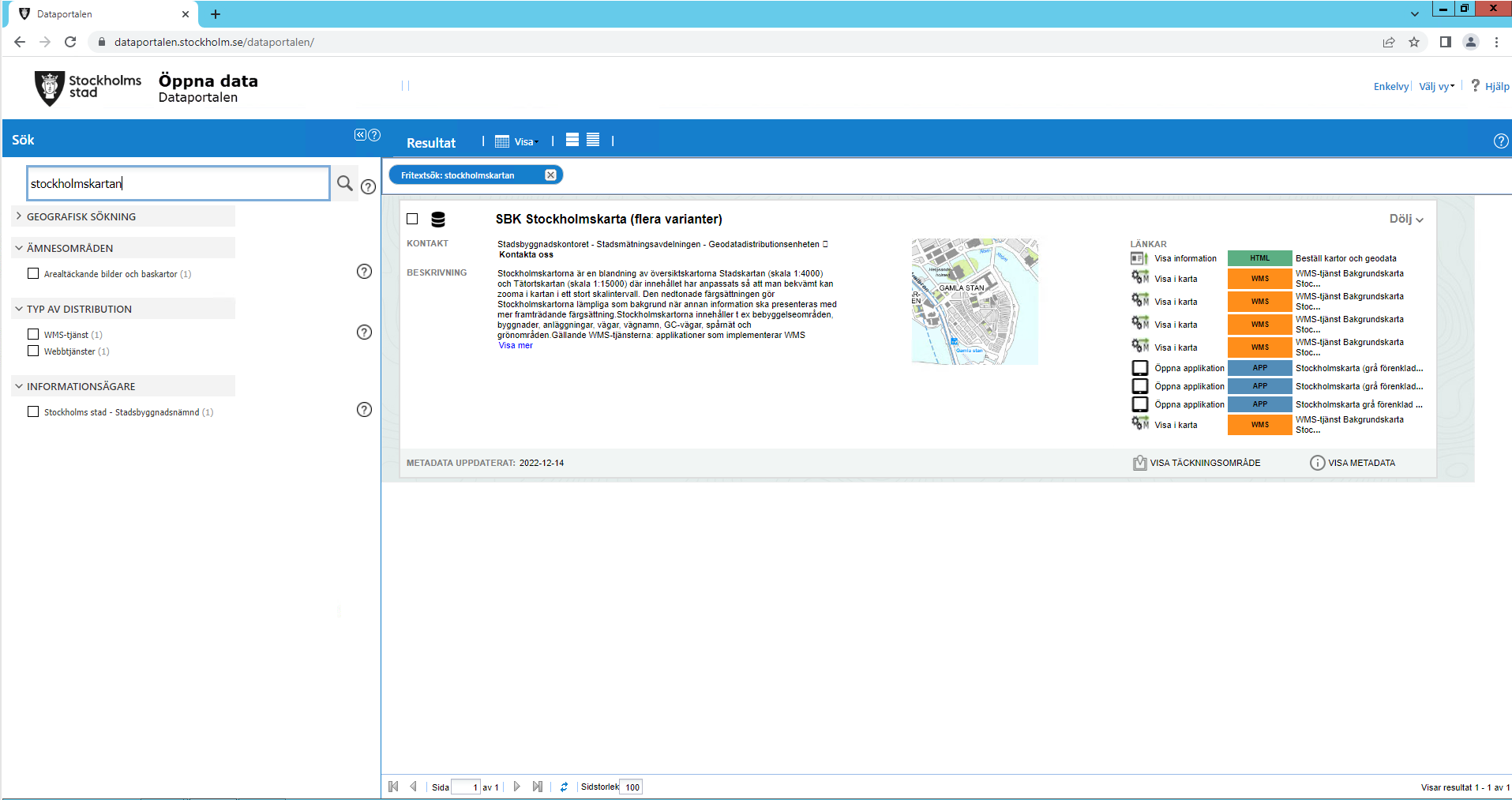
2) A click on the "i" icon will take you to the metadata for the map:
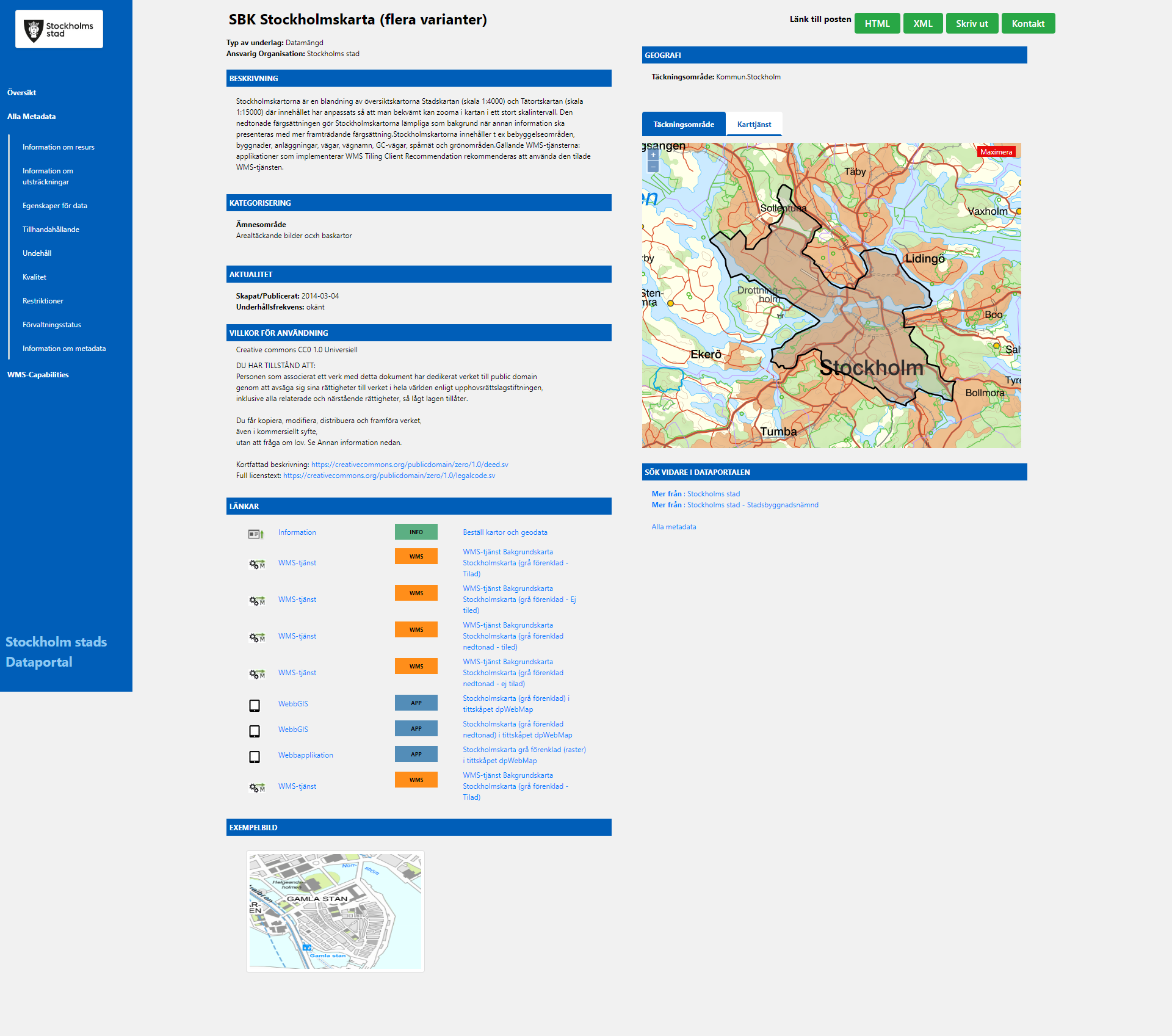
There are several versions of the map available. Copy the URL for the second option under "Links":
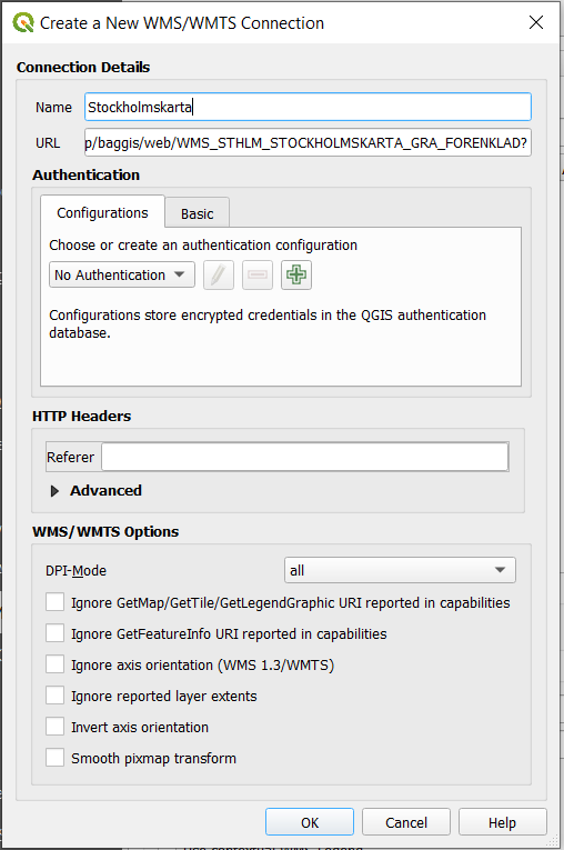
https://kartor.stockholm.se/bios/wms/app/baggis/web/WMS_STHLM_STOCKHOLMSKARTA_GRA_FORENKLAD?
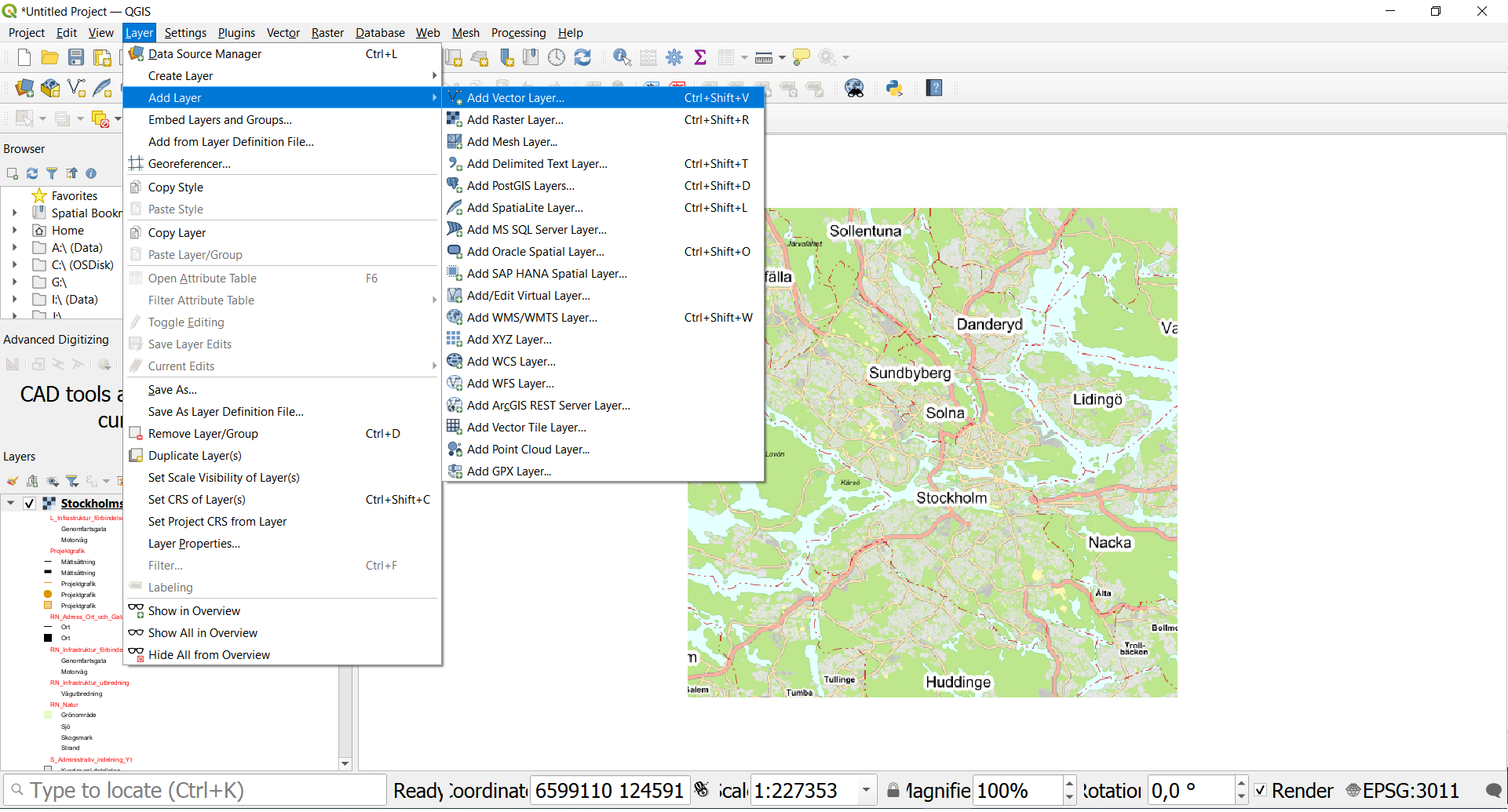
3) In QGIS, choose the menu option "Layer" > "Add Layer" > "Add WMS/WMTS Layer…" or alternately Ctrl-Shift-W.
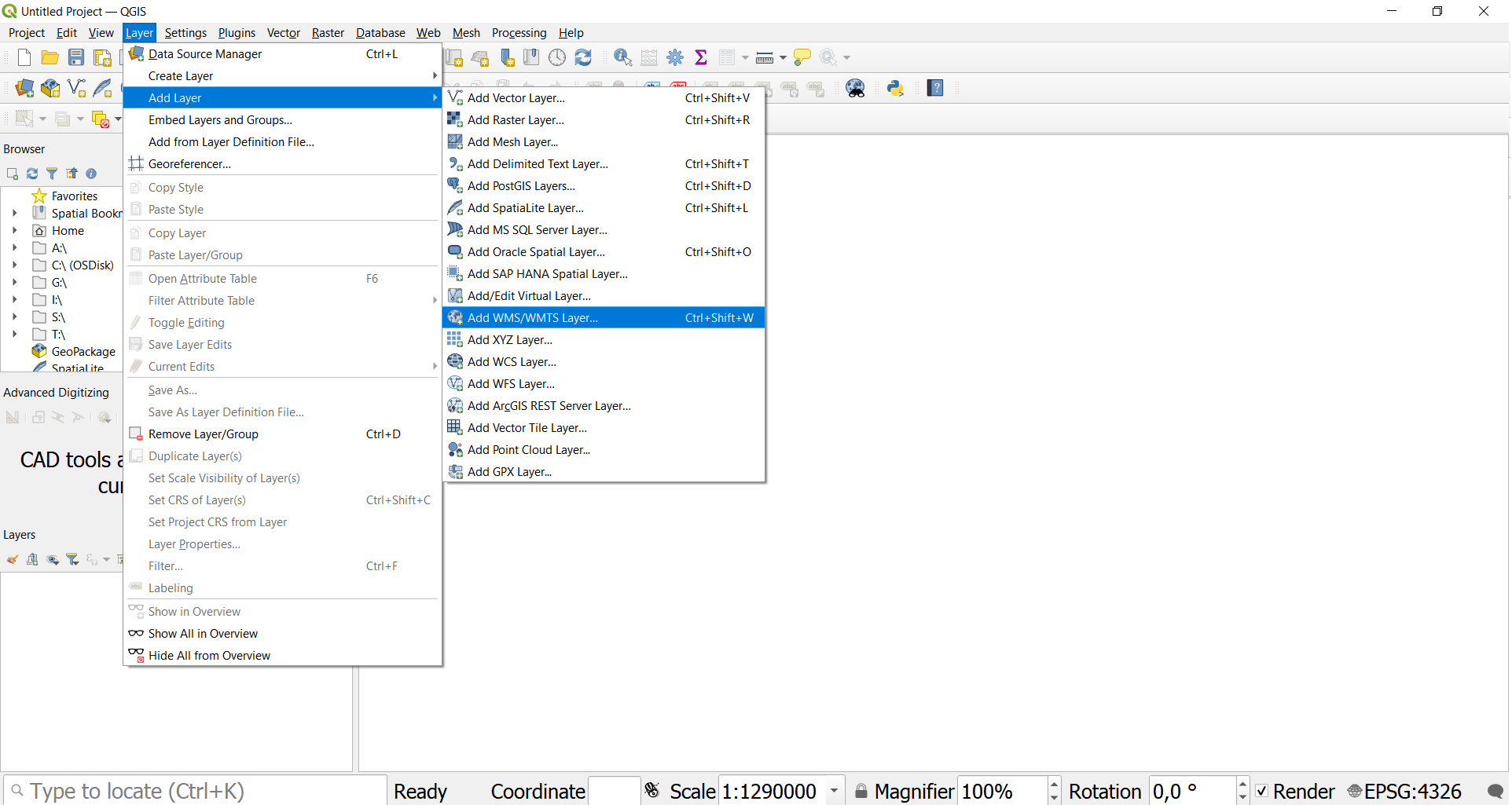
Then click on "New".
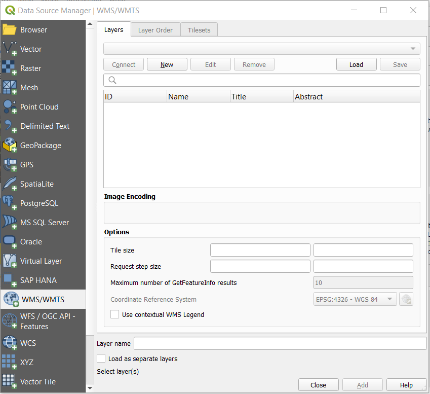
Name the new layer and paste the URL.
Press OK and then click on "Connect" to fetch the map data from the server.
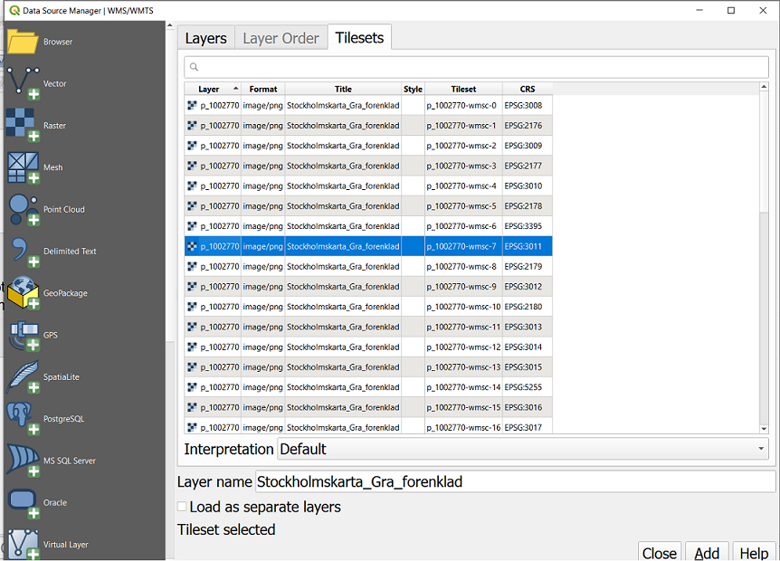
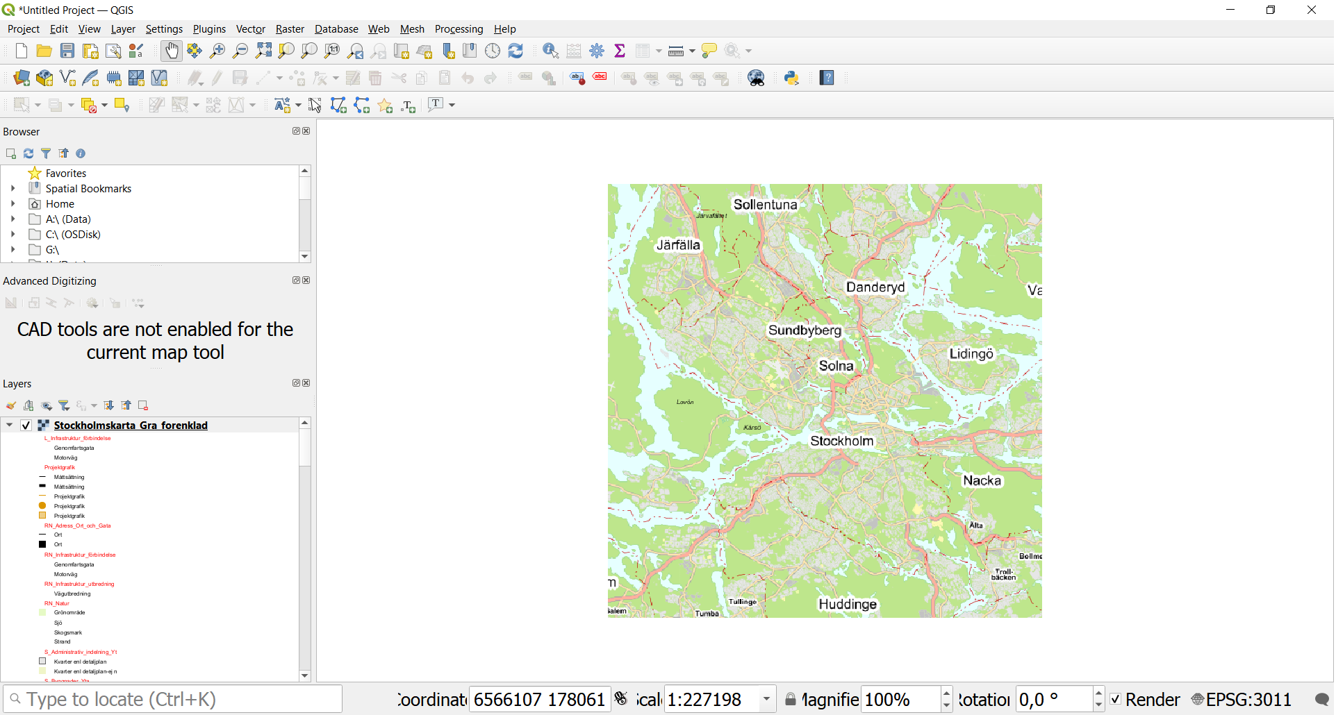
4) Choose a tile set from the list (the option using Coordinate system 3011 will be most appropriate for Stockholm), then click "Add" to import the layer and then "Close" to return to the map display.
5) Now we will import data showing the positions of the City bike stations in Stockholm.
Return to the data portal and search for "City Bikes".
Now we are going to download a geopackage-file containing the information. Copy the URL for "TK Open data GeoPackage export":
https://openstreetgs.stockholm.se/geoservice/api/DIN API-NYCKEL/wfs/?version=1.0.0&request=GetFeature&typeName=od_gis:CityBikes_Punkt&outputFormat=GeoPackage
Paste in your API-key instead of the text "DIN API-NYCKEL" in the link. Then paste the link in your browser. You should be prompted to download and save a gpkg file. Save the file.
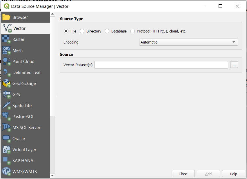
In QGIS, choose the menu option "Layer" > "Add Layer" > "Add Vector Layer…" or alternately Ctrl-Shift-V.
You will be prompted to open the vector layer. At this step, you can choose to import the geopackage file that was loaded in the previous step.
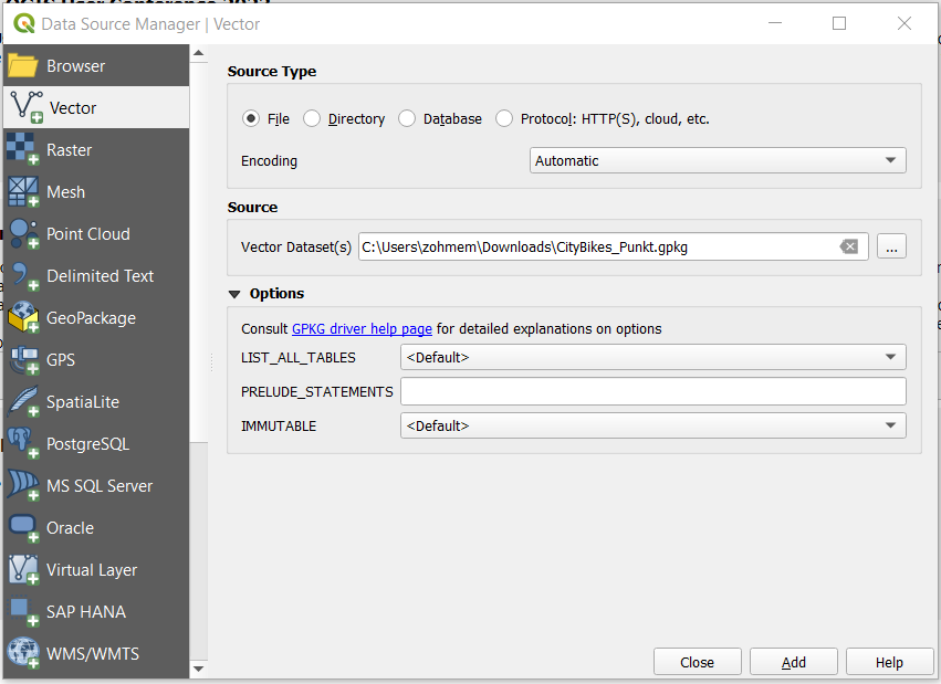
Click on "Add" and the data will be imported into the map, and then "Close"
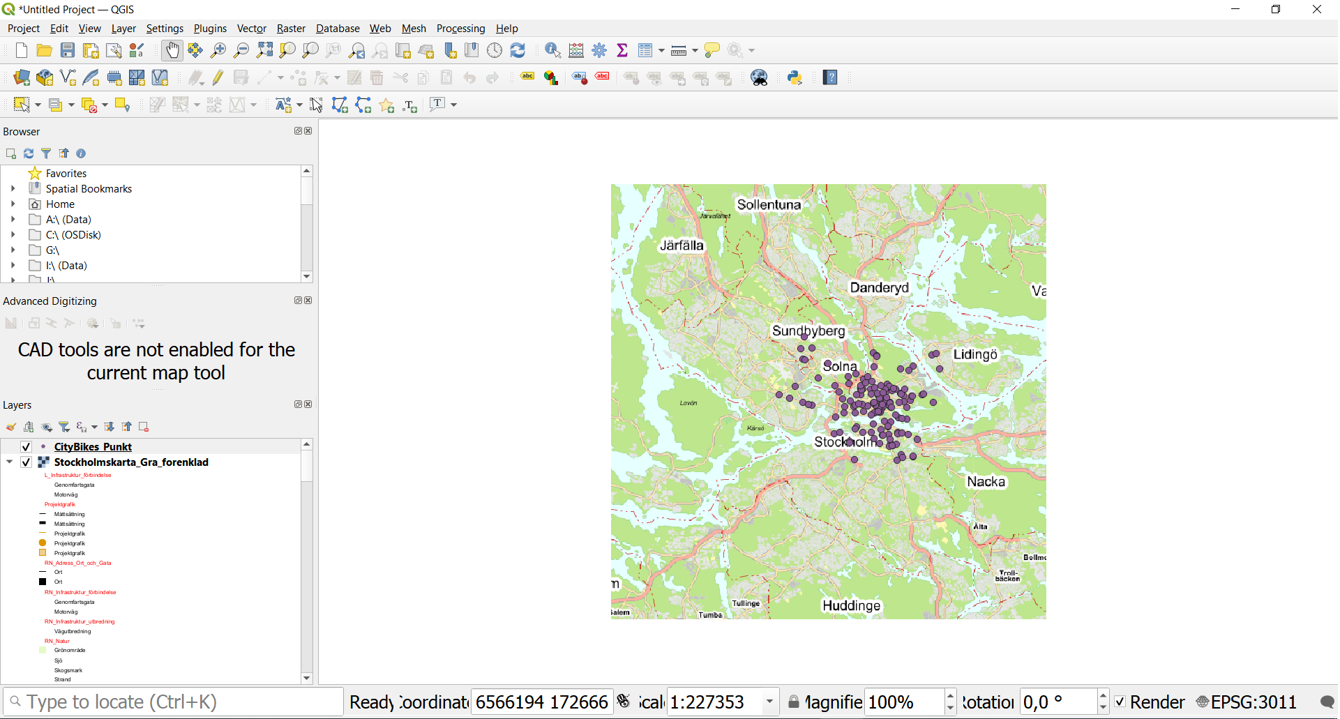
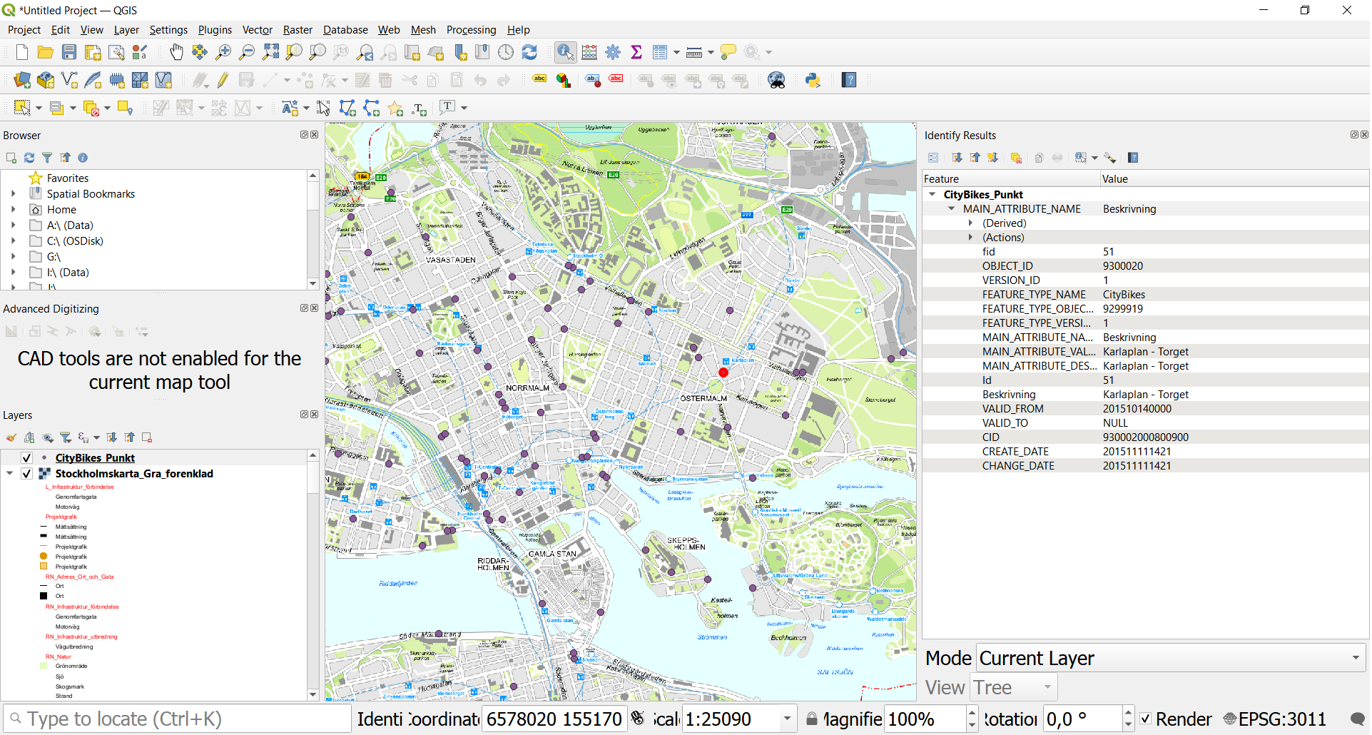
6) If you want, for instance, to get information about one of the bike stations, then use the "Identify Features" tool (icon showing a mouse-pointer over an information-symbol). Click on the chosen point and it's data will be displayed in the right panel: