


Data model
One of the most important objectives with Trafikkontorets road network platform is to provide a method for managing how information is connected to the road network. The positional information relative the road network is common for all informtion independant of type (defined by the standard SS 637004-1). The position of information is made with help of Extents relative to the road network (see figure).
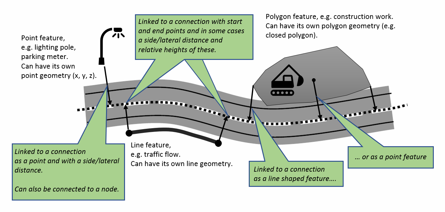
Extents are often, within the GIS-realm called dynamic segments of the road. In the database start- and end coordinates are stored for the extent refeering to the road parts natrual one dimentional and normalized coordinate system (S1 and S2). The extents lateral position, lateral distance or traffic lane are sometimes stored to give more apparent details on the position.
Information connected to the road network are called Features. A feature contains a desciption of values and attributes which can be arbitary of its type. A feature can be described relative to the road network using one or more extents. The structure of the data catalog is similar to the data catalog of NVDB.